Cape Cod is a geographic cape extending into the Atlantic Ocean from the southeastern corner of mainland Massachusetts, in the northeastern United States. Its historic, maritime character and ample beaches attract heavy tourism during the summer months. As defined by the Cape Cod Commission's enabling legislation, Cape Cod is conterminous with Barnstable County, Massachusetts. It extends from Provincetown in the northeast to Woods Hole in the southwest, and is bordered by Plymouth to the northwest.
Since 1914, Cape Cod has been separated from the mainland by the Cape Cod Canal. The canal cuts 28.2 km roughly across the base of the peninsula, though small portions of the Cape Cod towns of Bourne and Sandwich lie on the mainland side of the canal. Two highway bridges cross the Cape Cod Canal: The Sagamore Bridge and the Bourne Bridge. In addition, the Cape Cod Canal Railroad Bridge carries railway freight and limited passenger services onto the Cape. Cape territory is divided into 15 towns with many villages.
Provincetown is a New England town located at the extreme tip of Cape Cod in Barnstable County, Massachusetts, in the United States. A small coastal resort town with a year-round population of just under 3,000, Provincetown has a summer population of as high as 60,000. Often called "P-town" or "P'town", the town is known for its beaches, harbour, artists, tourist industry, and its status as a vacation destination for the LGBTQ community.
This post is part of the Our World Tuesday meme,
and also part of the Ruby Tuesday meme,
and also part of the Travel Tuesday meme,
and also part of the Wordless Wednesday meme.
Showing posts with label town. Show all posts
Tuesday, 21 November 2017
Wednesday, 21 September 2016
KIAMA, AUSTRALIA
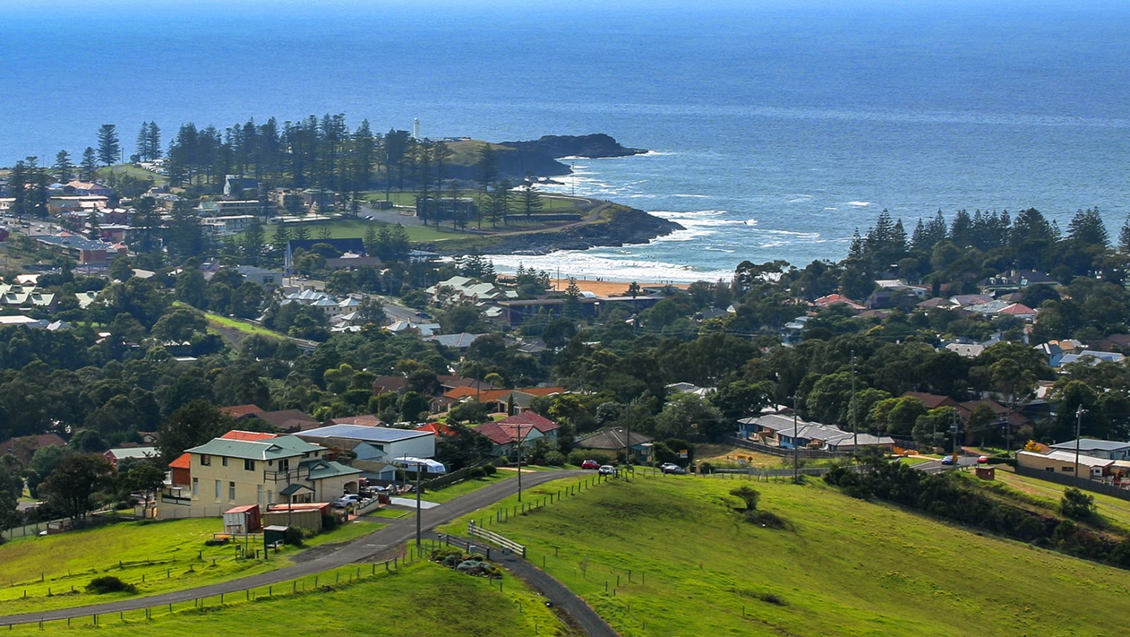
Kiama is a township 120 kilometres south of Sydney in the Illawarra, New South Wales, Australia in the Municipality of Kiama. At the 2011 census, Kiama had a population of 12,817 people. One of the main tourist attractions is the Kiama Blowhole. The seaside town features several popular surfing beaches, caravan parks and numerous alfresco cafes and restaurants. Its proximity to the south of Sydney makes it an attractive destination for a large number of day trippers.
The Kiama area includes many attractions, being situated on the coast south of the Minnamurra River, and to the west lie the foothills of Saddleback Mountain and the smaller less discernible peak of Mount Brandon. Also to the west is the town of Jamberoo with pasture-land in between, which contains many historic buildings and dry stone walls. Also of note is Seven Mile Beach to the south, a protected reserve. Kiama has several well-known surfing beaches, including Surf Beach, 'Mystics' and Boyds' Beach, as well as other more protected swimming beaches situated in coves between headlands such as Black Beach, Easts Beach and Kendalls Beach. Kiama Harbour forms one of several coves between headlands.
This post is part of the Wednesday Waters meme,
and also part of the Outdoor Wednesday meme,
and also part of the Wordless Wednesday meme,
and also part of the ABC Wednesday meme,
and also part of the Travel Tuesday meme.
Tuesday, 20 May 2014
SANTORINI, GREECE
Santorini (Greek: Σαντορίνη), classically Thera (Greek: Θήρα); is an island in the southern Aegean Sea, about 200 km southeast of Greece's mainland. It is the largest island of a small, circular archipelago which bears the same name and is the remnant of a volcanic caldera. It forms the southernmost member of the Cyclades group of islands, with an area of approximately 73 km2 and a 2011 census population of 15,550. The municipality of Santorini comprises the inhabited islands of Santorini and Therasia and the uninhabited islands of Nea Kameni, Palaia Kameni, Aspronisi, and Christiana. The total land area is 90.623 km2. Santorini is part of the Thira regional unit.
Santorini is essentially what remained after an enormous volcanic eruption that destroyed the earliest settlements on a formerly single island, and created the current geological caldera. A giant central, rectangular lagoon, which measures about 12 by 7 km, is surrounded by 300 m high, steep cliffs on three sides. The main island slopes downward to the Aegean Sea. On the fourth side, the lagoon is separated from the sea by another much smaller island called Therasia; the lagoon is connected to the sea in two places, in the northwest and southwest. The depth of the caldera, at 400m, makes it possible for all but the largest ships to anchor anywhere in the protected bay; there is also a newly built marina at Vlychada, on the southwestern coast. The island's principal port is Athinias. The capital, Fira, clings to the top of the cliff looking down on the lagoon.
The expansion of tourism has resulted in the growth of the economy and population. The major settlements include Fira (Phira), Oia, Emporio, Kamari, Perissa, Imerovigli, Pyrgos, and Therasia. Akrotiri is a major archaeological site, with ruins from the Minoan era. Santorini's primary industry is tourism, particularly in the summer months. Santorini was ranked world's top island for many other magazines and travel sites, including the Travel+Leisure Magazine, the BBC, as well as the US News.
This post is part of the Our World Tuesday meme.
Santorini is essentially what remained after an enormous volcanic eruption that destroyed the earliest settlements on a formerly single island, and created the current geological caldera. A giant central, rectangular lagoon, which measures about 12 by 7 km, is surrounded by 300 m high, steep cliffs on three sides. The main island slopes downward to the Aegean Sea. On the fourth side, the lagoon is separated from the sea by another much smaller island called Therasia; the lagoon is connected to the sea in two places, in the northwest and southwest. The depth of the caldera, at 400m, makes it possible for all but the largest ships to anchor anywhere in the protected bay; there is also a newly built marina at Vlychada, on the southwestern coast. The island's principal port is Athinias. The capital, Fira, clings to the top of the cliff looking down on the lagoon.
The expansion of tourism has resulted in the growth of the economy and population. The major settlements include Fira (Phira), Oia, Emporio, Kamari, Perissa, Imerovigli, Pyrgos, and Therasia. Akrotiri is a major archaeological site, with ruins from the Minoan era. Santorini's primary industry is tourism, particularly in the summer months. Santorini was ranked world's top island for many other magazines and travel sites, including the Travel+Leisure Magazine, the BBC, as well as the US News.
This post is part of the Our World Tuesday meme.
Tuesday, 13 March 2012
MIJAS, SPAIN
Mijas is a town and municipality in the province of Málaga, in Andalusia, southern Spain. It is a typically Andalusian white-washed village located at a mountain side about 450 m above mean sea level, in the heart of the Costa del Sol region. There are some local history museums and many souvenir shops, Mijas also has seven golf courses (four more are under construction) including La Cala Resort, the biggest golf resort in Spain.
This post is part of the Our World Tuesday meme
![]() |
| The Town Square |
![]() |
| Looking down towards the Costa del Sol and Torreblanca |
![]() |
| Picturesque coaches... |
![]() |
| ...Or donkey taxi! |
![]() |
| In a small irregular niche excavated at the head of the hermitage you´ll find the Virgen de la Peña, patron of Mijas |
![]() |
| One of the town's beautiful streets |
![]() |
| The hotel we stayed at |
![]() |
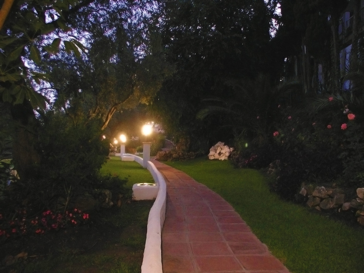
| Walking up the garden path to enjoy... |
![]() |
| ...the night in the gardens of Spain with a magnificent view and the smell of roses and Spanish jasmine |
Subscribe to:
Posts (Atom)